Road to Brough and Brough Castle
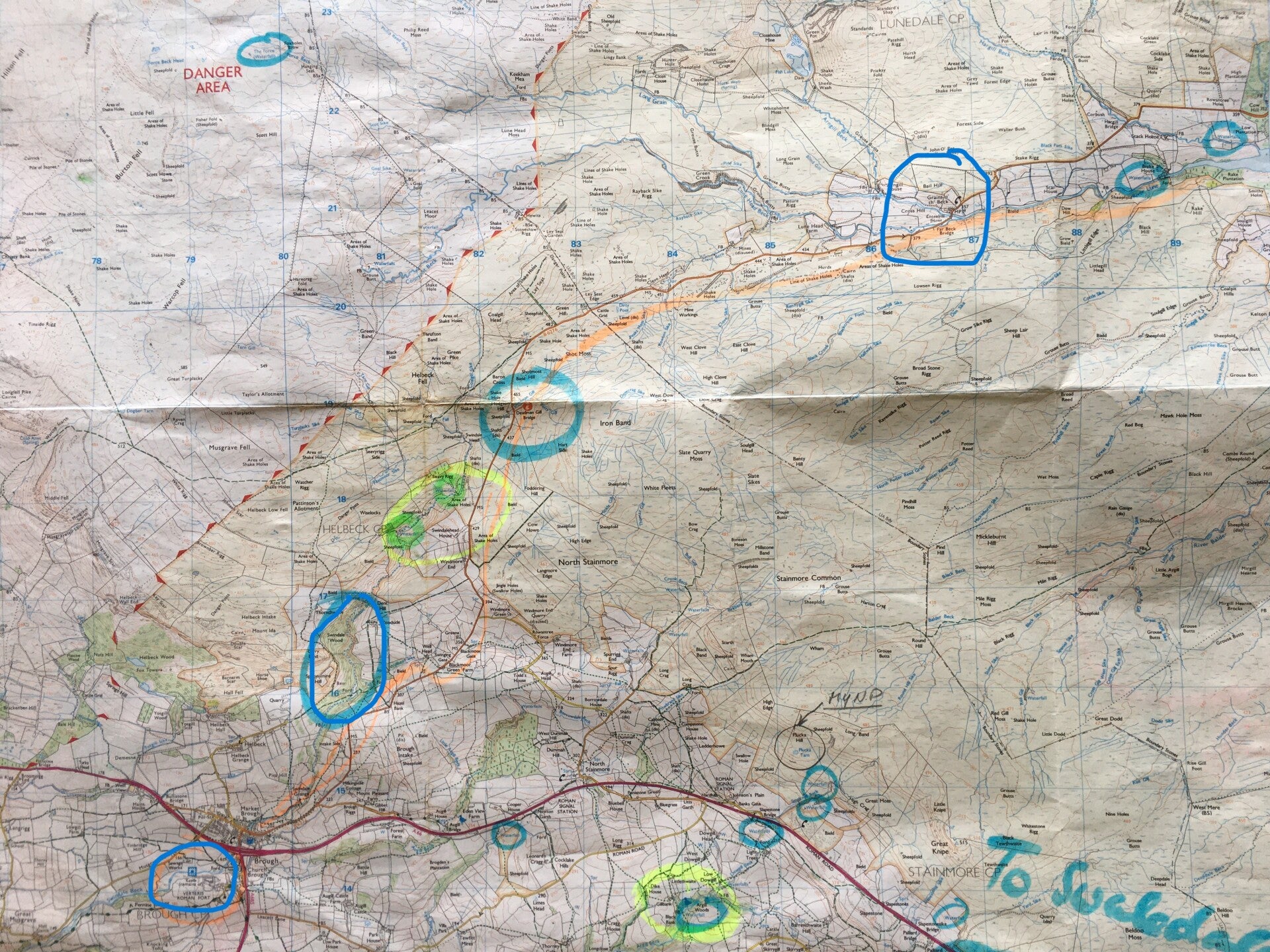
The trip was inspired by Anne and Haydn. When they came over to Curlew Cottage from Hexham for a visit they told me that they took this scenic route and particularly the views at the end of the road towards Brough and towards the Yorkshire mountains was really nice. The first map shows the start of the route with Middleton at the top. The second map shows the more western part of the route with Brough in the bottom left corner.
I set off very early as usual and the first obligatory stop was of course Kirkcarrion (circled on map #1). I found a convenient gate just below Kirkcarrion had a walk around the meadows just below and decided this would be the right location for trying out star photography at night. (Another topic on the Still To Do List).
As you can see from the Kirkcarrion photo the weather in Teesdale was fine but it got worse and worse while I followed the road further along. You can see that the sky gets darker and darker in the photographs. I had a longer stop and a good walk and climb around "Grains o´ th´Beck" (top right of map #2) with its nice hump back bridge, during which the rain already set in. Photos # 12 to 18 (numbering includes the maps) are all from that area.
I took my time on the remainder of the drive until I came to the point where the road starts dropping down to Brough. (just below Swindale Wood circled on Map #2 on the left). It was still raining so I decided to have an early picnic up there. Finally the rain cleared away and I got some shots of the valley down below with Brough Castle in the distance (centre right on picture #23)
Anne and Haydn were right. The views are really great from up there. Unfortunately the weather permitted me from taking more photographs. The two photos of the lonely barn and the farm (most likely "Intake Farm" underneath Swindale Wood) were taken on the way back.
Brough Castle is really worth a visit. Entrance is free and there are very good panels all around giving you explanations about the setup and the history of the castle.
Like Bowes Castle it was built on the foundations of a roman fortress. Built in about AD 79–80, Verteris was one of a chain of Roman forts guarding the strategically important road from York (Eboracum) to Carlisle (Luguvalium).
The earthworks represent an 11th-century castle, but the visible remains date from the 12th century onwards. The castle was a seat of the celebrated Clifford family for 450 years, and enjoyed a last lease of life in the 17th century thanks to the work of Lady Anne Clifford.
If you want to read more about it´s history there is a really good and detailed website by English Heritage:
History of Brough Castle | English Heritage (english-heritage.org.uk)
Photo #30 shows the remains of what is depicted on the panel on photo #29. Photo #31 is the view from the castle grounds towards the fells where I had the picnic and took the shot looking down onto the castle from above.
After a nice rest at the Castle Cafe I drove back the same way but towards the end made a detour down to Grassholme Farm (circled on map #1) where I took the photos of the reservoir. I crossed the bridge and drove back along the small lane into Mickleton where I took some more photos which are shown on the next page.